


Enterprise License:
- Subscription with support for corporate deployment and packaging
- Additional users $1095 per year
- All installations use the same license key and serial number
Features:
- Includes one free Country Package (a $695 value)
- Extensive Census and demographic data for the following Country Packages: United States, Australia, Brazil, Canada, France, Germany, Italy, New Zealand, and United Kingdom
- Detailed, accurate, updated maps for all Country Packages
- A complete, out-of-the-box solution for mapping your data
- Tools to visualize business, customer, and demographic data using maps
- Exports maps into your presentations, documents, and Microsoft Office to clearly illustrate your message
- Finds geographic patterns that cannot be seen in database tables and spreadsheets
- Answers the geographic questions that impact your operations
- Builds territories, evaluates sites, defines optimal routes, locates addresses, and much more
Description:
Maptitude mapping software gives you the tools, maps, and demographic data you need to analyze and understand how geography affects you and your business.
You will be amazed at how quickly you can enhance your decision making using this easy-to-use mapping tool. In a few easy steps, you can locate your addresses, color code Postal/ZIP Codes with your data, build rings around your locations, and much more.
With Maptitude you can:
- Visualize data in new and different ways
- Understand geographic patterns and trends
- Present information in clear and attractive ways
- Integrate demographics and Census statistics with your own data to identify the geographic characteristics of your organization and operations
Unlike many other mapping and GIS software packages that require users to purchase data separately, Maptitude includes extensive geographic and demographic data so you can get started as soon as you open the box. Each Maptitude license includes a FREE detailed Country Package and a basic global map. Each Country Package includes:
- A street layer with addresses for pin-mapping (geocoding) and travel-time information for computing routes and drive-time rings.
- Administrative/political boundaries, transportation infrastructure, and comprehensive named landmarks that range from public facilities to commercial buildings including shops, restaurants, and retail stores
- Most Country Packages also include postal data, building footprints for many urban locations, and detailed demographics
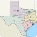 |
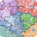
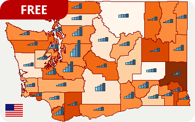
TERRITORY MAPPING Create territories automatically or interactively |
 |
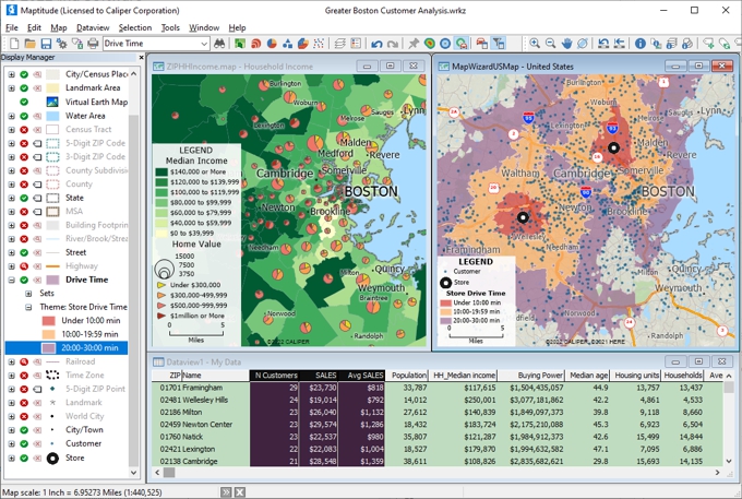
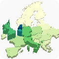
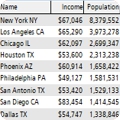
EXTENSIVE MAPS, DATA, AND DEMOGRAPHICS Use the included Census, demographic, and map data (including streets) to create powerful maps |
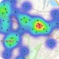 |
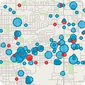
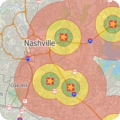
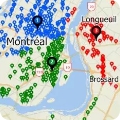
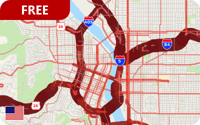
HOT SPOTS MAPS Identify geographic concentrations of customers, crimes, disease outbreaks, and more. |
 |
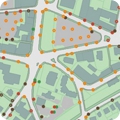
PIN MAPPING Locate (geocode) your customers, facilities, and other resources by address, postal code, city, coordinate, or manually. |
 |
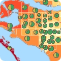
HEAT AND THEMATIC MAPS Create heat, shaded, chart, 3D, dot-density, scaled/sized, and many other types of map visualizations |
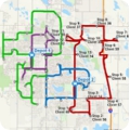 |
ROUTES Find shortest paths and efficient routes for serving multiple locations |
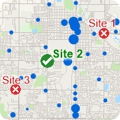 |
FRANCHISE AND SITE SELECTION Use maps to analyze the best locations for retail/franchise site selection or any other facility placement problem |
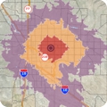 |
DRIVE-TIME RINGS Create time and distance rings to see the areas reachable within time limits you define |
 |
DATA IMPORT Use data files from hundreds of table, spreadsheet, GIS, CAD, and GPS formats plus satellite/aerial imagery and Google Earth formats |
 |
LOCATION-BASED ANALYSIS Use a variety of tools to analyze the demographic characteristics of target areas |
 |
CATCHMENT AREAS A street-based territory tool creates areas based on drive time or distance or create straight-line areas of influene |
 |
GEOGRAPHIC FILTERS Filter features based on location, proximity to other features, radius, shape, or based on a value or condition |
 |
DATABASES Integrates a professional strength relational database with powerful geoprocessing for spatial queries, polygon overlay, and other location-based analyses |
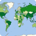 |
WORLD MAPPING Includes a FREE basic world map and one detailed Country Package |
Please see the Maptitude Overview page to learn more about Maptitude.

“Maptitude is an excellent GIS program and is priced very low considering the value it provides. I
highly recommend this program to anyone looking for basic to complex functionality in a GIS program.”
Jesse Greer, Director of Inside Sales, Abbott Inc.

“Overall, this product makes it incredibly simple to visualize and map both customer & company
specific data. It is very intuitive and easy to pickup from the get go.”
Matt Rosenfield, Regional Operations Specialist, Wayfair

“The software is very easy to use and can do a lot of analysis. It has helped me a lot with making
strategic decisions for my analysis.”
Rima Idir, Remarketing Strategy Analyst, Kubota Corp.

Reviews
There are no reviews yet.